Posts Tagged ‘maps’
Edible Boulevards Community Resources for Spring

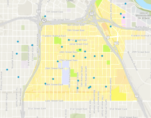
.embed-container {position: relative; padding-bottom: 80%; height: 0; max-width: 100%;} .embed-container iframe, .embed-container object, .embed-container iframe{position: absolute; top: 0; left: 0; width: 100%; height: 100%;} small{position: absolute; z-index: 40; bottom: 0; margin-bottom: -15px;} By MICHELLE SHAW Do you live in Cedar Riverside, Ventura Village, Midtown Phillips, Phillips West or East Phillips? If so, that means you live in the Southside Green Zone and you’re eligible to apply for participation in the Minneapolis Edible Boulevards initiative. We have funding to go towards teaching people how to transform the space between the sidewalk and curb into an edible boulevard, in addition to free soil testing, seeds, organic soil, compost, garden gloves, and a trowel if you need one. The application is posted on our Minneapolis Edible Boulevards Facebook page, which we invite you to join. We’re excited to announce a few new community resources that we’ve just [...]
What happened to my old polling place? Redistricting!

Article #1 in a series about the 2022 midterm elections; brought to you by the League of Women Voters of Minneapolis Left: 2022 State House district boundaries of Phillips Right: 2022 City Council wards in black, former boundary in red It’s spring — flowers are blooming, birds are singing, and the Hennepin County Elections office is sending postcards to registered voters. You may find that your voting district and polling place have changed. What happened? In 2022, many people will experience a change in their voting district. This process is called redistricting, and it happens every ten years, as states, counties, and cities across the country adjust their political boundaries to fit new census numbers. Because the population of Minnesota has changed, the sizes and boundaries of congressional, state, and local districts need to adapt so that each has approximately the same number of people. That will ensure that the value of each vote remains equal. In [...]


