


")

Article #1 in a series about the 2022 midterm elections; brought to you by the League of Women Voters of Minneapolis

It’s spring — flowers are blooming, birds are singing, and the Hennepin County Elections office is sending postcards to registered voters. You may find that your voting district and polling place have changed. What happened?
In 2022, many people will experience a change in their voting district. This process is called redistricting, and it happens every ten years, as states, counties, and cities across the country adjust their political boundaries to fit new census numbers. Because the population of Minnesota has changed, the sizes and boundaries of congressional, state, and local districts need to adapt so that each has approximately the same number of people. That will ensure that the value of each vote remains equal.
In Minnesota the process starts with the legislature and governor. The political parties redraw maps for our eight congressional, state legislature, and metropolitan council districts. It can be tempting for parties to try to design these areas for their own particular advantage, sometimes resulting in weird shapes and unusual inclusions. This is called gerrymandering. Our system in Minnesota is set up to avoid gerrymandering. Here, when the parties and the governor don’t agree, as has happened for the past 50 years, the Chief Justice of the Supreme Court appoints a redistricting panel to draw new boundaries. The panel completed its work in February.
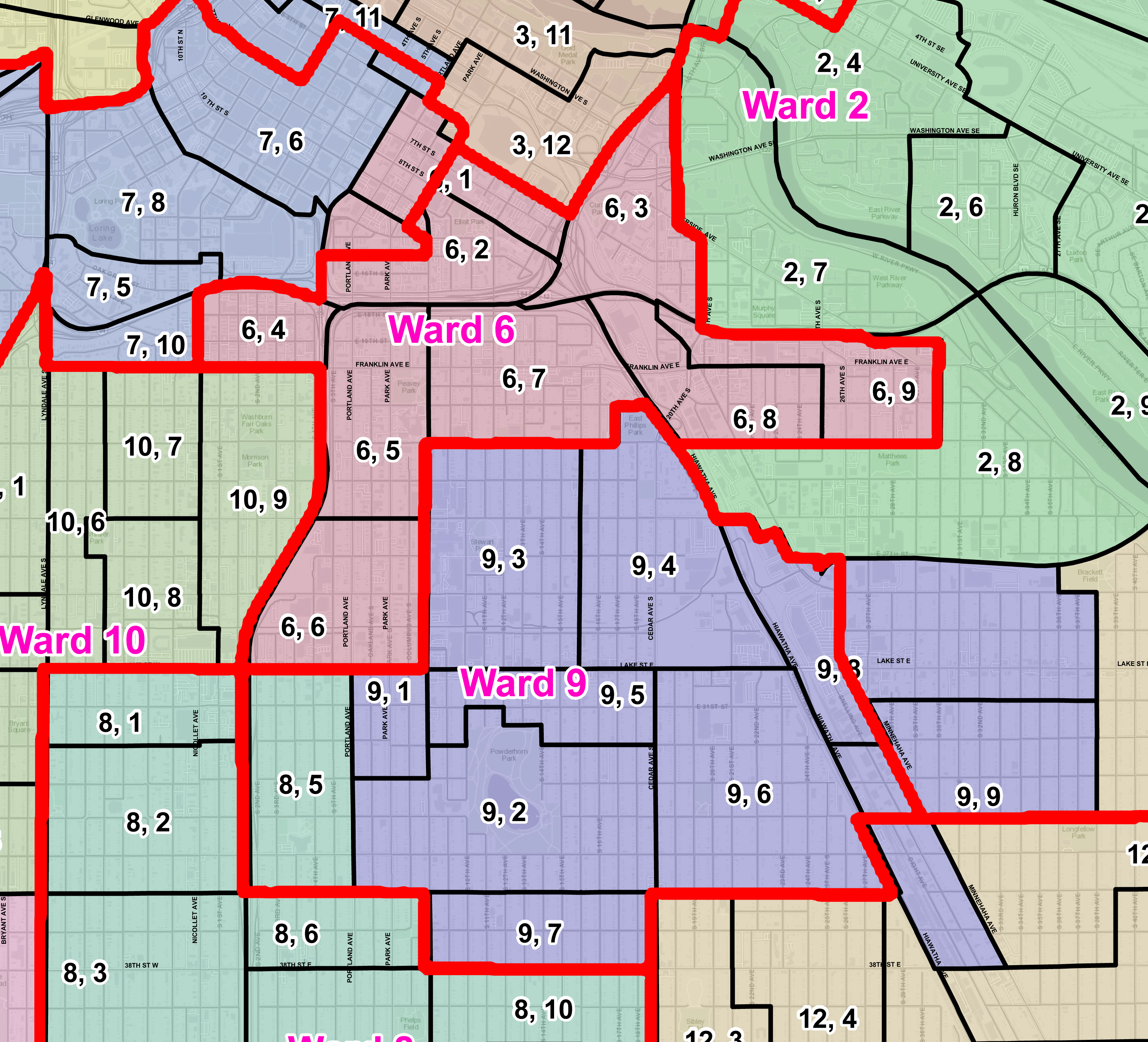
When congressional and state legislative boundaries are determined, local redistricting begins. Cities, county boards, and school districts set their own local boundaries. The Minneapolis Charter Commission, with the help of an advisory group, and input from the community, draws the maps for Park Board districts and the city’s wards and precincts.
The panels charged with adjusting voting districts are subject to specific rules, such as creating districts that are convenient for voting and are approximately equal in population. They also should make sure that voters who belong to communities of color and Native American tribes are able to fairly elect their representatives.
When local maps are completed and approved by the Minneapolis City Council and the Park Board, notices of updated polling places will be sent to all registered voters. Thus, before the primary election, we will know if our district and precinct have changed and where we can vote. The process itself, with all of its approvals and bipartisan committees, ensures that our individual vote is equal to one in any other part of the state. It’s good to know that we have as much clout as any other voter.